Detour through the mountains
November 19-20
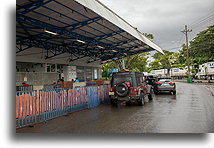
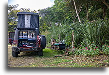
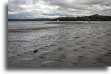
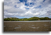
Before we could enter Nicaragua, a COVID-19 test was required. To meet the requirements, we went to the Liberia Airport. There are many international flights, so a large test center was set up in the tent in the parking lot. We quickly took PCR tests, but we had to wait until the next day to get the results. The closest was Eco Camping Papagayo, located near the popular with tourist Culebra Bay. We chose this place for the night. The local Panama beach turned out to be muddy. Nothing spectacular. After driving along the coast of a large part of the Nicoya Peninsula, we came to a simple conclusion. Beaches in Costa Rica’s Pacific side are ugly. We hit the road right after breakfast. On the way at the airport, we printed negative test results and headed towards the border.
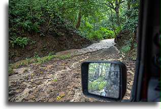
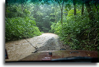
Not more than 15 km / 10 miles from the Nicaragua border, traffic on the highway stalled. It turned out that the truck with the semi-trailer fell into a ditch blocking the entire road. Nobody was able to bypass it. Police estimated that help to get truck out could come from the capital in 7 hours. Everyone I spoke to was devastated. Even the local drivers assured me that there was no alternative route to the border. Back in the car, I started browsing the navigation map on our OPC and concluded that we should try to take a detour through the mountains. There was a network of small roads marked in white. We turned back, entered the first village, and our steep climbs up and down began. A downpour began, and the little-used dirt roads quickly turned into streams of mud. After one of the very steep descents, I stopped on the bank of the river. It was not wide, but I did not want to enter the water blindly. Due to heavy rainfall, the water level rose quickly. The rule number one of water crossing is to walk through the water first. I took my shoes off and walked into the river myself. I had to assure the right water depth and make sure there was no mud at the bottom. I was all wet, but at least I knew that the risk of getting stuck in the water was slim. Based on the map, we were only supposed to have two water crossings, but several small rivers in this area were not marked. At one point, we even had to drive downstream with the river instead of the traditional crossing from one bank to another. We ended up crossing the brown muddy water eleven times until we reached the village and finally the asphalt road. What a relief.
Delayed, we reached the border crossing. Another hour and half for the formalities and we were in Nicaragua. Our next stop, colonial Granada on the Lake Nicaragua.
